GPS writing
Practice ground reference maneuvers
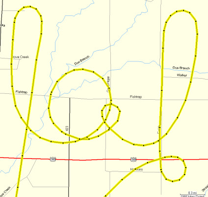
Pick a day where the winds are light, or windy if you want a challenge. Pick something to write and trace it out with your plane. Then download the track from your 396/496 to your computer. Here is how Mapsource, the Garmin program, can display the data. The GPS was of no use during the flight. I didn't see the see the result until I got home to my computer. The loop on the "o" was a 60-degree turn.
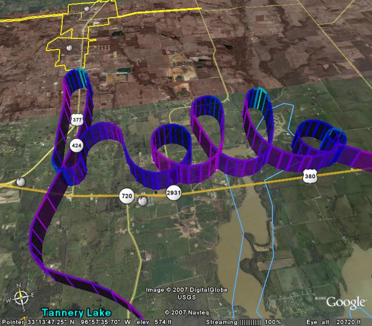
A free program called GPSvisualizer can take the track file and encode altitude and speed data. This can then be read into Google Earth. Really neat stuff
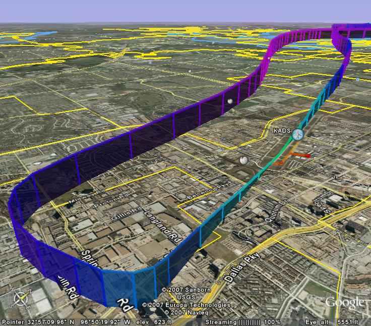
Another view, showing the landing and take-off with altitude and speed. Flew a nice pattern that day.
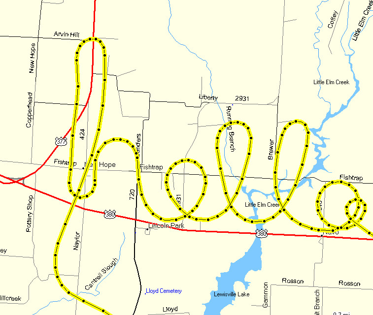
Some more practice with the 60-degree turns.